
Between South Bass Canyon and Boucher Canyon are a series of remote canyons with names like Emerald, Ruby, Sapphire, Jade, Topaz that very few had seen or heard of. The only way to access them is to traverse the Tonto route between those canyons. There are no perennial water sources along this stretch, no escape routes to the rim, no access to the Colorado (except for a few rumored possible difficult points of access to the Colorado based on heresay). There is a narrow window of opportunity to attempt the route where water might be available in potholes and seasonal springs in the canyons. Amongst the few who had attempted the route, some succeeded, others needed to be rescued, some have gotten lost and not been found. I had been intrigued by this No-Man’s land section of I first climbed down the canyon (via the then ill-defined and “unlisted”) Boucher trail 15 years ago.
Unlike the well-traversed section of Tonto trail between South Kaibab and Hermit canyons, this section was no walk in the park although it looks like a smooth continuous trail on the topo map; the Tonto route along this remote “Gems” section is not a continuous or defined trail but a loose network of routes that stop and start at different elevation levels which constantly break off and swerve through boulder fields and talus slopes and skirt the edges of slippery shale and sandstone ledges. Days settle into a relentless rhythm of constantly gaining and losing elevation as one contours in and out of side canyons to stay atop the Tonto shelf.
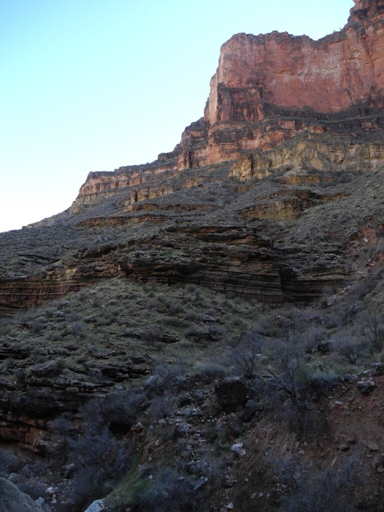
We climbed out of South Bass on the 7th day and began the Gems route. The first canyon we encountered, Serpentine Canyon, lived up to its name – it was long and difficult; we contoured in and out of its many meandering side drainages, sometimes losing our way during the deep descents and ascents as we scrambled up and down rockfalls and daunting landslides. It was also bone dry; it was a good thing we had taken a detour to South Bass beach the day before to replenish our water supplies. The trip reports I had come across involved groups of people that started the route fresh. Between Jeremy and myself there was no margin for error or weakness, if something happened to either of us there were no additional persons to parcel out and redistribute the load to keep moving. The other person would be saddled with the other’s load which would be difficult with our already laden packs, and invariably slow us down where our food supply (already diminished by the ravens’ theft) would run out.
Furthermore we were not starting fresh like the other groups, we had already been hiking for 6 days doing the difficult Royal Arch route, and I had not recovered from my injuries sustained. The sun would be blazing out where the Tonto shelf opened up on the stretches traversing between canyons and it would become chilly as it narrowed and fragmented reaching the shadow of the canyon whose tops were still covered with snow. We camped at Emerald canyon that evening, there was no water where it was indicated on the topo maps but we saw some water in potholes below the Tonto about 30 feet below. Jeremy climbed down the ledges to filter and replenish our water supply from the potholes, we opted to hold the extra 8 liters I hauled from South Bass beach in reserve for the next day just in case. After he climbed up and set the bladders down, Jeremy put on his jacket and climbed onto an outcrop ledge. He sat there in silent thought looking out at the canyon as the orange sun set and purple dusk fell. I stayed back and quietly setup our campsite for the night and organized our gear and supplies for tomorrow. I recognized his desire and need to be alone with the canyon, I was not the only one to share my heartache with the canyon. I was awaken again by the light of the stars and the moon that night, and I laid in my sleeping bag till dawn pondering where this path, and my path would lead.
Overgrown plants, fallen rubble and boulders obscure the view of the path, so it is easy to get off route. Many times you are going by the subtle tread in a plant or rock that may have been shifted, and the occasional imperceptible hint of a shadow of a faded footstep by someone who might have walked the same way before – which could have been weeks, months, years, or decades ago.
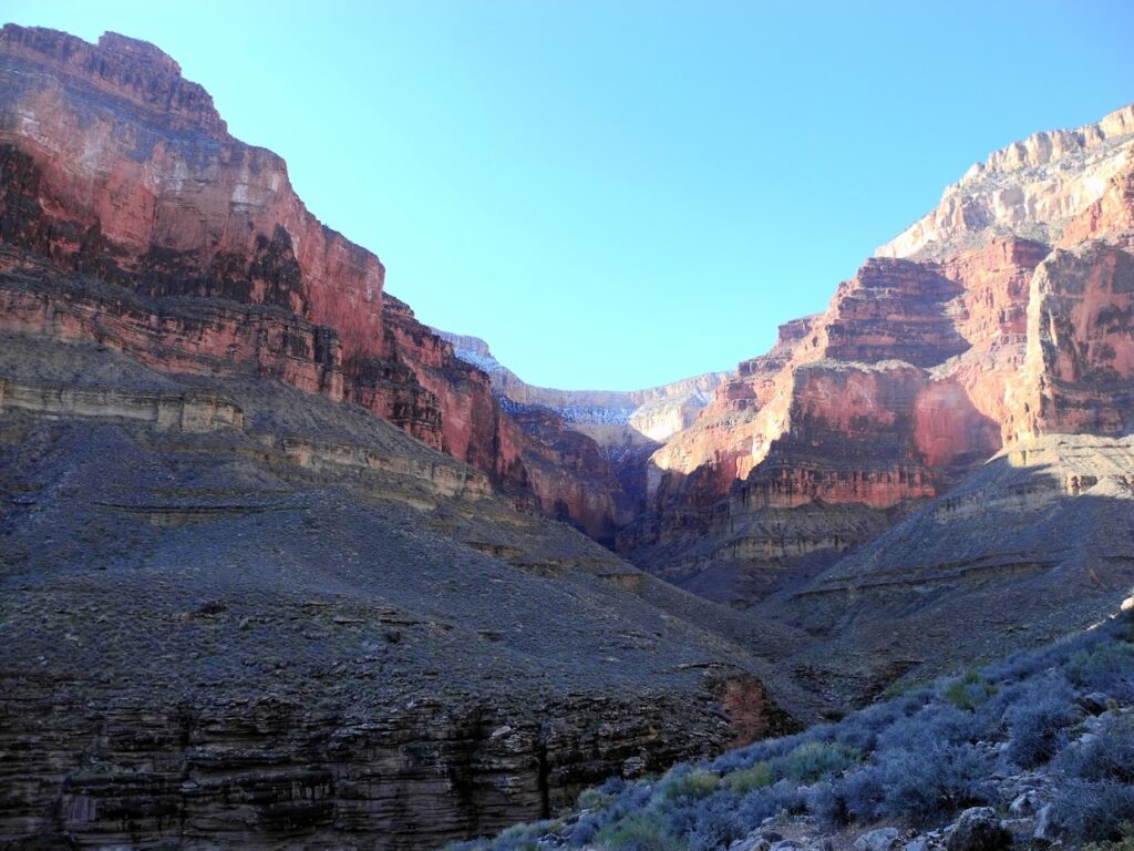
You cannot blunder blindly through this section of the Tonto, it is not easy to always stay on course and requires focused concentration in choosing and finding your way to the path as it appears and disappears. Missing a drainage join means you end up wandering lost, and a little mistake can result in you meandering widely off course. Many times you have to stop and backtrack to find your way again.
The plan on the 8th day was to continue on and camp in Ruby canyon where there was a high chance of finding water based on others’ trip reports. But the canyon we ended up in that evening did not resemble descriptions of Ruby canyon, and it was dry. Jeremy and I pored over the topo maps, trying to pinpoint our location, and mentally retraced our route on the map. Things still did not line up. Eventually we realized instead of camping in Emerald canyon last night as we thought, we had actually camped at Quartz canyon, having mistaken one of the arms of Serpentine canyon as another canyon. This meant we had overshot Ruby canyon. Rather than backtracking, we decided to push on to Turquoise canyon that had a seasonal spring marked in the topo maps and hope for the best.
As I followed the shelf that turned and headed into the head of Turquoise canyon, I knew I was off-course when I saw its contact point with the Tonto shelf. I was too high up. I pulled out my GPS and managed to secure a reading that looked about right, it put me 250 feet above where I was supposed to be. I thought of backtracking and connecting with the correct shelf but as I traced the GPS track, I realized that a mile ago I had gotten onto a slightly different elevation, and that small change magnified and diverged over the course of the mile. Backtracking would involve a detour of two miles. The sun was setting and I did not want to tackle the rough, overgrown, rubble-strewn slopes into Turquoise in the dark. I decided to carefully work my way down and hoped I would be able to identify the correct route when I reached it. When I reached it, it looked no different from the other rocky overgrown layers, but my instincts honed from spotting subtle signs since Royal Arch told me it was the right one. The closer I got to the head of the canyon, the surer I was it would meet at the correct contact point. I followed it as the light fell, stumbling over the rocks, and reached the head of Turquoise canyon where Jeremy was waiting for me with bad news, Turquoise was bone dry. For the second time, the extra water I had diligently filtered and hauled saved us again.
“What are you writing?” Jeremy asked “I noticed you were writing a lot.”
“Oh, just recording where we found water.” I lied as I closed the notepad where I used to jot down my daily experiences and thought fragments.
As we played dominoes in the light of our headlamps, I listened as Jeremy mused about his plans. He was originally from Mississippi and had originally planned to become a doctor but he fell in love with the Grand Canyon and became a professional guide. Like me, he was struggling with a toxic work environment with the company he worked for and was not sure what to do next. He was also thinking of moving out of the house he shared with other roommates, and build a life with his girlfriend; but he was unsure where to move to, or where she might be assigned after she completes her training.
“In the end,” Jeremy declared “Home is where you want to be, not where you have to be.”
I smiled in recognition of the exact realization and phrase I had uttered 15 years ago after my first trip into the Grand Canyon.
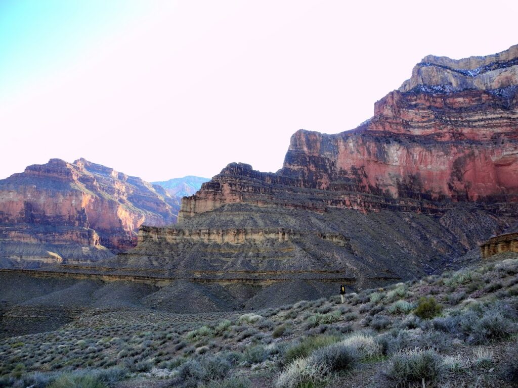
As you stumble over obstacles, slip on loose rock, skirt precipices, get stung by cacti, and get lost; every decision you make affects the course of future decisions. If we cannot find any water today what will happen if I use up my water? Is there a pothole of unevaporated snow melt a day away, or two days away? Should I hold my pee in case I need to drink it in an emergency? Should I slake my thirst with the remaining water I have left or risk dehydration or heatstroke? If I slow down to rest, will I be forced to reach our destination in the dark? If I speed up now, will I have enough reserve energy left if there is a difficult obstacle around the next canyon? I eventually developed a technique where I would stop and take a sip every 15 minutes in order to pace my progress as well as my water ration instead of guzzling it down whenever I got tired so I never ran out of water or energy.
As you wind in and out and climb up and down canyons and their drainages, and their side drainages, you realize although you may be on the right path, you will never see the full view of your destination, but it gradually reveals itself in bits and pieces with each step. Unlike the typical “grand” views one gets on mountaintops and viewpoints, there is no line of sight to the distant horizon that presents its same entirety to everyone else. You choose which direction to look, you determine the view you see as you forge on ahead.
For each joy in coming across an occasional cairn (and knowing you are on the right route), there are many more frustrations in following false cairns and routes as heat and exhaustion play tricks on your eyes and mind. Sometimes the right route is in the opposite direction you expect, forging ahead where you think it should be just gets you lost. And at times you emerge onto a featureless plain of scrub and talus with no apparent route – or apparently infinite routes.
I had become complacent and assumed it was going to be easy based on the topography of the Le Conte and Shaler platforms, but I kept getting lost during the traverse picking up false routes made by animals and occasionally false cairns presumably made by humans. The route was so indistinct that it did not help whether I tried going by faint shadows that hinted at prior passage or feeling the tread on my feet. Once you got off route, it was difficult to get back on. I wound up wandering around, constantly backtracking, and even getting lost during backtracking so by the end of the ninth day, I had lost confidence gained in my route finding abilities at the end of the 9th day.
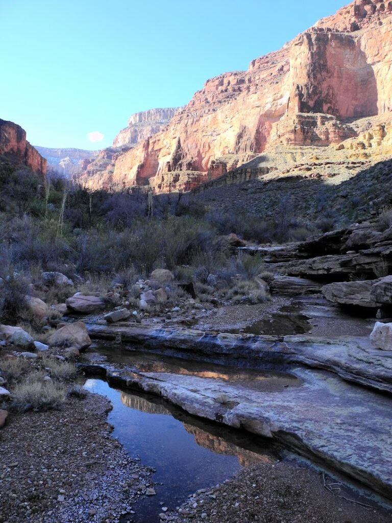
We camped before Slate canyon on a full moon at the end of the 9th day. We had crossed Sapphire canyon earlier which was dry at the contact point but the bed had some indications of moisture. Working our way up canyon, we spotted a life giving spring that appeared and vanished into the dry canyon bed above the Tonto contact. We dropped our packs to take a break and quickly filtered some water to drink, we were almost out of water at this point. After slaking my thirst, I got to work filtering water to replenish our exhausted water supply. It took a while to filter all 15 liters and I fell into a meditative reverie working the pump, surrounded by the walls and the sounds of the canyon.
In the midst of this reverie, the fragmentary thoughts about the trials I had experienced; of finding water, dangling over a frozen waterfall, negotiating boulder jams with my busted foot, etc. began to coalesce and I understood what the obstacles and near-death experiences I had encountered since Royal Arch with a clarity. What I had done before is not as important as what I am capable of doing. I had fretted whether there was meaning in my sufferings in the past, I now knew that was pointless. There is none; it is what you had to do to get to where you want to be. Sometimes one has to search for an alternate route, other times one cannot make it no matter how much one tries – and that is ok. I had been beaten down by the obstacles on the route and in life (whether work, or relationships, or government, or bipolar condition) but I had prevailed. For years I had been constantly denigrated by others and made to feel worthless and less than, yet I had compensated and overcome the obstacles I had been dealt like those on the route. My journey is my own, not the accomplishments, nor the mementos or waypoints I had to collect; I did not have to do it like everyone else. And thus I rediscovered my own power and awesomeness.
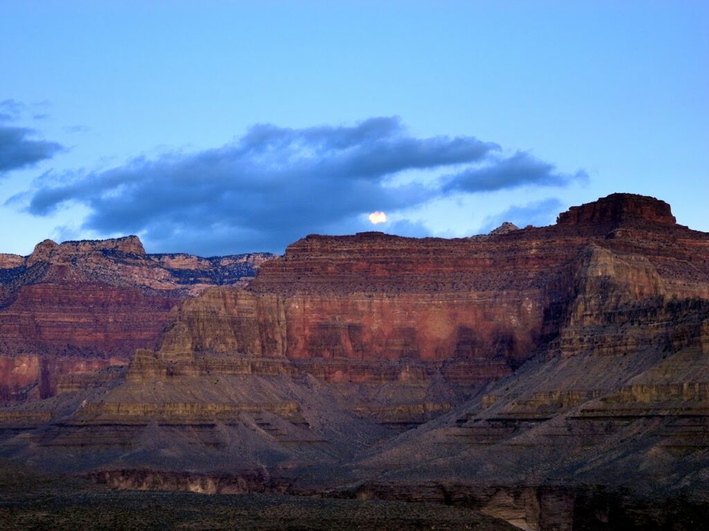
As I watched the moon rise over the distant rim that night, I realized it was the fifteenth day, or the last day of the Lunar New Year that marked a new year, a new beginning. My thoughts and experiences of the Gems route, the route finding and the frustration of getting lost played in my mind and somehow they coalesced and I came to a profound realization on what the trip and the Gems route meant.
After you blunder (yourself, and by following false trails those before had left) more times than you care to count on the wrong path. You realize it is not about how many times you have gotten lost, but how you find your way back; through perseverance and presence of mind. The right path is not not always easy to follow (you have to keep checking you are on the path and spot path ahead / beside you). Beware of routes that offer apparent “safety”, these false alternatives don’t get you ahead to the next drainage, and more often than not mire you in untenable situations (e.g. rockslides, cliff edges).
And you realize that you have traversed a lifetime. Not just a microcosm of your life (closer to your 40s than 20s) but also of the Earth and its inhabitants embodied on the very strata you are standing on. Each fallen cairn you choose to rebuild, and each tread you choose to take on the route makes it more distinct for others to follow, like those who had taken it before you. I had been lost for a very long time and will lose my way again; but I will try and try and find my way back.
<< CRATERING – RIM II | GEOLOGY OF HEARTBREAK | CRATERING – RIM IV >>